 Bertolami Fine Art - Piazza Lovatelli 1, 00186 Roma
ASTA 287 Stampe antiche e moderne, matrici, carte geografiche e fotografia Stampe antiche e moderne, matrici, carte geografiche e fotografia
martedì 20 febbraio 2024 ore 14:00 (UTC +01:00)
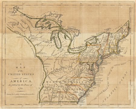
A Map of the United States of America as settled by the Peace of 1783. 1785
A Map of the United States of America as settled by the Peace of 1783. 1785
acquaforte e bulino, 22,5 x 26,5 cm. Mappa del Nord America, con golfo di Mexico e Florida. Impressa su carta vergata, con traccia di consuete pieghe editoriali. In ottimo stato salvo ossidazione. Con cornice, vetro e passe-partout (32 x 36 x 2 cm ca.).


