 Bertolami Fine Art - Piazza Lovatelli 1, 00186 Roma
WEB AUCTION 116 - STAMPE ANTICHE E MODERNE, CARTE GEOGRAFICHE WEB AUCTION 116 - STAMPE ANTICHE E MODERNE E CARTE GEOGRAFICHE
Wednesday 18 May 2022 hours 14:00 (UTC +01:00)
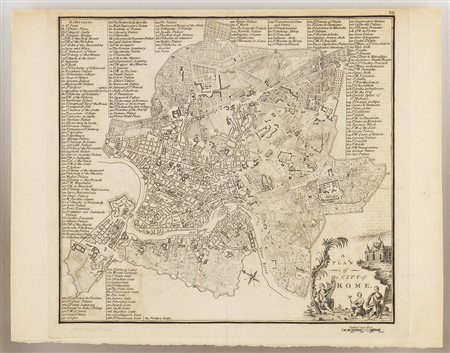
DA JOHN ANDREWS (1736-1809): A Plan of the City of Rome, 1800
da John Andrews (1736-1809)
A Plan of the City of Rome, 1800
da John Andrews (1736-1809)
A Plan of the City of Rome, 1800
Bulino
25 x 32,5 cm
Bell'esemplare stampatu su carta vergata. In buono stato, salvo le traccie di una piega verticale ed una orizzontale ed un restauro al verso della piega verticale. Con cornice doppio vetro (37 x 46,5 x 2 cm).

