 Bertolami Fine Art - Piazza Lovatelli 1, 00186 Roma
WEB AUCTION 116 - STAMPE ANTICHE E MODERNE, CARTE GEOGRAFICHE WEB AUCTION 116 - STAMPE ANTICHE E MODERNE E CARTE GEOGRAFICHE
mercoledì 18 maggio 2022 ore 14:00 (UTC +01:00)
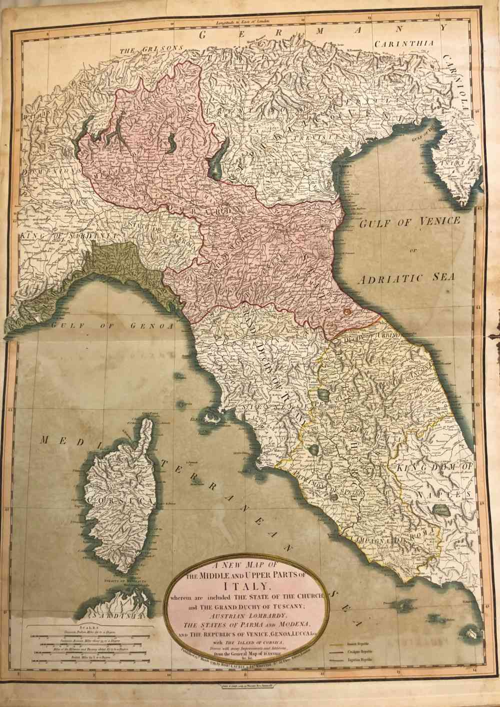
: A New Map of the Middle and Upper Parts of Italy…
A New Map of the Middle and Upper Parts of Italy…
Bulino
73 x 53,2 cm
...wherein are included the State of the Church, and the Grand Duchy of Tuscany, Austrian Lombardy, the States of Parma and Modena, and the Republics of Venice, Genoa, Lucca, &ca. with the Island of Corsica
Mappa di Italia settentrionale e centrale, pubblicata nel 1799 a Londra da Robert Laurie and James Whittle.
Stampato su due fogli di carta non vergata, uniti. Colorazione coeva. Macchie di colore causate dalla piegatura. Macchie di inchiostro sul margine destro. Un strappo. Leggera increspatura sul bordo superiore.